- UK Information
- UK Guidebooks and Maps
- Liverpool books and maps
Liverpool books and maps
Here is a list of books for Liverpool that you may find useful.If you plan to travel to Liverpool you may be interested in some guide books and travel books that will help you plan your stay in Liverpool and to find your way around. Click on any book for more information or to buy.
Liverpool books: Maps

Liverpool Mini Map (A-Z Mini Map)
1 pages
9 x 5.8 x 1 cm
Price: £2.50
Publication: 18 Mar 2012


1 pages
9 x 5.8 x 1 cm
Price: £2.50
Publication: 18 Mar 2012

Liverpool, Southport and Wigan (Landranger Maps)
This map is part of the Landranger (Pink) series and is designed for people who really want to get to know an area. It includes the following information: tourist information, camping and caravan sites, picnic areas and viewpoints, selected places of interest and rights of way information for England and Wales. Each map in the series covers an area of 40 km by 40 km (25 miles by 25 miles) and like other Ordnance Survey maps, National Grid squares are provided so that any feature can be given a unique reference number. Perfect for planning ahead and local excursions, these maps are full of useful information that will help you really get to know an area.
Price: £5.24
Publication: October 22, 2003

Liverpool, St Helens: Widnes and Runcorn (Explorer Maps)
OS Explorer Map is the Ordnance Survey's most detailed map and is recommended for anyone enjoying outdoor activities like walking, horse riding and off-road cycling. Providing complete GB coverage the series details essential information such as youth hostels, pubs and visitor information as well as rights of way, permissive paths and bridleways.
Price: £5.99
Publication: September 8, 2004
![Merseyside Street Atlas (A-Z Street Atlas) [Illustrated]](/images/books/1843486911.jpg)
Merseyside Street Atlas (A-Z Street Atlas) [Illustrated]
This spiral bound street atlas of Merseyside includes coverage of Liverpool, Birkenhead, Ellesmere Port, Runcorn, Skelmersdale, Southport, St. Helens, Warrington, and Widnes. There are 170 pages of continuous coloured street mapping extending from central Liverpool to:
Formby
Southport
Ormskirk
Orrell
Ashton-in-Makerfield
Culcheth
Lymm
Appleton Thorn
Frodsham
Helsby
Neston
Hoylake
Wallasey
Also included is a large scale city centre map of Liverpool, and a postcode map and road map of the atlas area. The street mapping features postcode districts, one-way streets and safety camera locations with their maximum speed limit.
The index section lists streets, selected flats, walkways and places of interest, place, area and station names. Also included is a separate list of the hospitals, NHS Walk-in Centres and hospices covered by this atlas.
Price: £8.36
Publication: 1 Dec 2010 [Spiral-Bound]
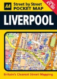
Pocket Map Liverpool (AA Street by Street)
Offers Liverpool's mapping in a pocket-sized format. This map includes NCP car parks and one-way streets, public toilets, pubs, hotels, petrol stations and public buildings.
Price: £1.50
Publication: 31 Jan 2008
Offers Liverpool's mapping in a pocket-sized format. This map includes NCP car parks and one-way streets, public toilets, pubs, hotels, petrol stations and public buildings.
Price: £1.50
Publication: 31 Jan 2008
Liverpool books: Travel Guides

Liverpool (Pevsner Architectural Guides: City Guides S.)
This guide book describes all the architecturally significant buildings in central Liverpool, and gives an account of the city's overall physical development. It includes some suburban areas of outstanding interest, and excursions to notable sites further out. Major buildings - such as the Town Hall, St George's Hall, and the two Cathedrals - are singled out for extended treatment, the streets of the business district are dealt with alphabetically, and the rest of the city - including the docks - is covered in a series of carefully planned walks. The book is based on Nikolaus Pevsner's original text for the Buildings of England, augmented by close study of the buildings themselves, and extensive new research into published sources and original documents. Illustrated in colour throughout, mostly with specially commissioned photographs, but also with historical images, including building plans, maps, and architects' drawings, it is a detailed, authoritative, and practical guide to the buildings of a city which in 2008 will be European Capital of Culture.
Price: £10.00
Publication: October 2004

Liverpool, pocket guides, 2nd
This vibrant series covers over 150 destinations worldwide, from cosmopolitan urban delights to sun-kissed beach idylls. Bursting with insightful and easily accessible information, these guides are full of practical information on how to make the most of a city break or longer holiday.
Price: £5.00
Publication: 10 Mar 2011
Liverpool books: General Interest
Scouse International: The Liverpool Dialect in Five Languages
Price: £2.99
Publication: February 2001
Price: £2.99
Publication: February 2001
The Liverpool books listed on this page are for your information and to help you find the books you need quickly. We do not endorse any particular books and are not responsible for the advice and information in the books listed.
The price of books, where indicated, was correct at the time the book was added to this page. Prices may have changed on the booksellers web site.